Leave this model? You can start a new one from here.
Anoor Maps
Pick the ground · type the place or upload a run · from $35
See a place that matters, from a new perspective.
A handcrafted, true-to-scale 3D model of anywhere you choose.
Shape Display
Choose a shape and size, then personalize the map inside it.
Choose a shape
Classic Displays
Includes an acrylic case
Desk, Cube, and Shelf Displays — each includes a fitted acrylic case and arrives ready to display.
Make a map of your place
Enter an address and we make your place like the piece below. Change anything, or leave it to us.
Made for
What you're making
How it's made
Add your run a run, ride, hike or ski day, from a GPX file
Export a GPX from Strava, AllTrails, Garmin, or another activity app.
What's this, and how do I get a GPX file?
What this does: uploading a route renders your specific hike, run, or ride as a highlighted path on your display, in its own color — separate from the streets and buildings around it.
Getting a GPX file:
- Strava — desktop only: open the activity on strava.com, click the ⋯ menu, then Export GPX.
- AllTrails — open your map or recording on alltrails.com, click More (or Download Route), then choose GPX.
- Garmin Connect — desktop only: open the activity on connect.garmin.com, click the ⋯ menu, then Export to GPX.
Strava and Garmin Connect don't support GPX export from their mobile apps — use a desktop browser for those two. Then come back here and tap Upload GPX.
Build-a-route currently works in Illinois and Utah. You can route freely within either state, but not between the two. Planning a route somewhere else, or one that crosses both? Upload a GPX file instead.
Choose a starting point, then add destinations one at a time - each leg follows real, known trails and roads (never a straight line you draw yourself), and you'll pick from a few suggested alternatives for each leg. Always confirm a suggested path is actually appropriate and safe before you go - Anoor doesn't know current trail conditions, closures, or access rules.
Build a route by clicking points on the map.
Click the map to place this point.
Search for a nearby address, landmark, park, or trail. Select a result to route to it immediately.
Search results © OpenStreetMap contributors
Choose a route to this point:
Your uploaded route doesn't overlap your selected map area.
This is the route from your saved design. Please re-upload it to continue with a new size or location.
Search, then pan and zoom. Everything inside the frame will be brought to life.
Popular
Location found
Move or zoom the map below to fine-tune your build area.
Search results © OpenStreetMap contributors
Mark your spot a heart, a pin, a house or a star - on a building, its roof in your color
Or tap the piece where you want it.
Color your building its roof, in its own color 1 chosen
Adjust your selection
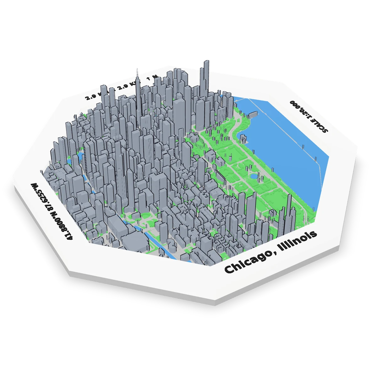
Ordering more than one? Save 10% on 3+, 40% on 10+ — add more from the confirmation screen.
Colors
As shown · you'll pick colors on the preview, turning it in 3D
Water stays blue.
How far it reaches
Words on the frame the front, top and sides - keep ours, or put your own
Front
Creating your model
Your model is being created from real map data.
You can safely leave this tab open.
Usually about a minute
Generation failed
Here's your place.
Take a look from every angle.
Shipping and payment on the next screen. Crafted and finished by hand, shipped ready to display.
Not ready to order?
We'll send you a link to this exact design.
Your design is finalized.
Continue to Shopify to complete your purchase.
Combine this map with other custom maps in one order. You can mix designs and quantities. Adding to your cart doesn't purchase or reserve this design.